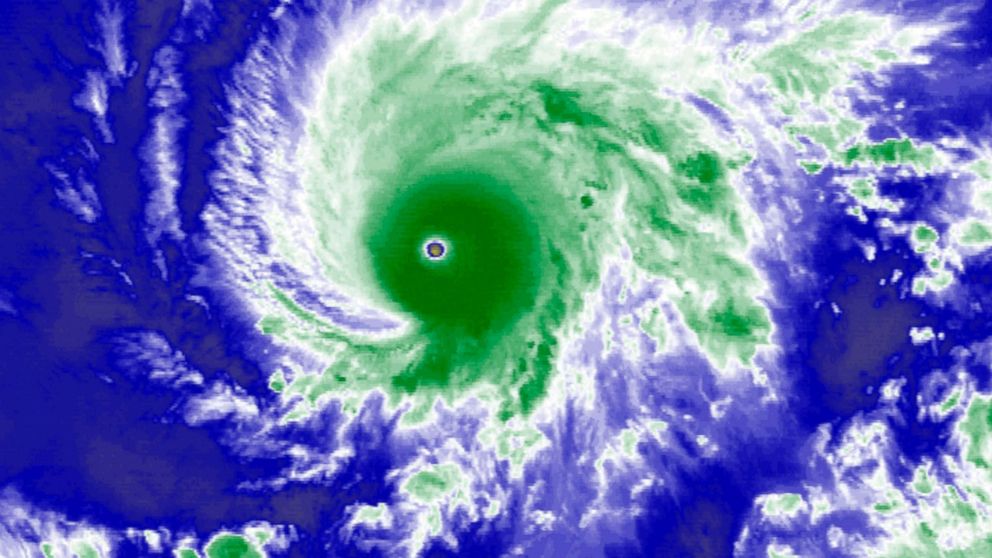
A Category 4 hurricane with winds up 130 miles per hour is approaching the Hawaiian islands.
Hurricane Lane is expected to track very close to the islands Thursday and Friday. It may weaken slightly as it approaches, but the storm is expected to maintain hurricane strength.
Some computer models show Lane could make landfall near Maui, but other models have Lane moving west and away from the islands, which would decrease the storm’s overall impact.
Though Lane’s path isn’t certain, Hawaii is expecting torrential rain over the next few days with a potential for life-threatening flash floods and landslides.
Widespread rainfalls of 10 to 15 inches are possible, with more than 20 inches possible in some areas.
Eight inches of rain already fell within 12 hours on the Big Island. A flash flood warning was issued for parts of the island.
Life-threatening surf is also expected across the islands over the next few days. The large waves and storm surge will push water levels two to four feet above normal tide levels along the state’s south and west shores.
It’s rare for hurricanes to hit Hawaii. An area of high pressure that sits to the northeast of the islands typically steers hurricanes away. This high pressure is the strongest from May through October, which is also prime hurricane season.
Hawaiian islands are also surrounded by cool water and tropical cyclones need ocean water temperatures to exceed 80 degrees to strengthen.
The last hurricane to make landfall in Hawaii was Iniki in 1992. Lane would be the third on record.
Category 1 Hurricane Dot hit in 1959 and catastrophic Category 4 Iniki came ashore in 1992. Both made landfall on the island of Kauai.
Category 1 Iwa also had a major impact on Kauai in In 1982, but because its eye did not hit the island, it wasn’t officially counted as making landfall there.


