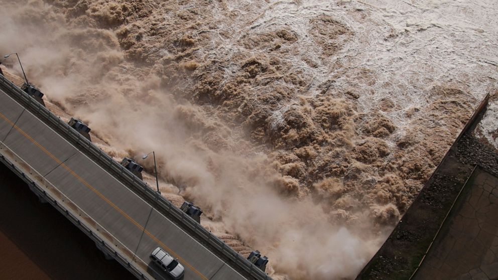
Officials on Saturday warned some Tulsa residents to prepare to head to higher ground because old levees holding back the swollen Arkansas River are stressed and more rain is expected for the flood-weary region.
The river was four feet above flood stage on Friday and was already causing flooding in parts of Oklahoma’s second-largest city, including in south Tulsa where the murky brown water had inundated low-lying neighborhoods and crept right up to the River Spirit Hotel and Casino, which closed for the weekend.
City officials said at a news conference Saturday that people living west of downtown should consider leaving for higher ground, even though the levees aren’t currently considered to be in danger of failing. If an evacuation becomes necessary, it would need to happen quickly, they said.
Mayor G.T. Bynum said the levees were built in the 1940s and haven’t had to hold back this much water since 1986. Officials also said they don’t expect the river to recede in Tulsa until Wednesday at the earliest, pushing back their initial estimate by three days.
“The level of risk you have in staying there is very high,” Bynum said. “That’s an unnecessary risk.”
Storms have buffeted the central Plains and Midwest all spring, inundating the ground and leaving rain with nowhere to go but into already bloated waterways. The region’s most recent spate of bad weather and flooding has been blamed for at least nine deaths.
Downriver in northwestern Arkansas, between 100 and 200 residents had already evacuated their homes in the state’s second-largest city of Fort Smith, which is about 100 miles (160 kilometers) southeast of Tulsa. Karen Santos, a spokeswoman for the city of roughly 80,000 people, said at least one house along the river had been completely submerged.
Laurie Driver, a spokeswoman for the Army Corps of Engineers, said the increased release of floodwater from upriver dams would affect Arkansas’ levee systems, which also haven’t been tested for as much water as is expected.
“When you’re in territory you’ve never been in before, you’re not sure if the levees are going to be breached or not,” Driver said, though she added that most were in “good shape.”
The National Weather Service said it expects the river to reach 41 feet (12 meters) near Fort Smith by early Monday morning, which would be 3 feet (0.91 meters) higher than its previous record, which was set in 1945. This would cause “near catastrophic flooding” in Fort Smith’s low-lying neighborhoods and business district, it said.
Arkansas Gov. Asa Hutchinson declared a state of emergency Friday night to free up state agencies to do what they can to assist flooded areas.
Additional storms are possible in Arkansas, Oklahoma and Kansas over the next week, according to the latest forecasts.
In Indiana, officials said Saturday that water levels had dropped slightly on a rain-swollen creek in the north of the state where a 4-year-old boy was swept away Thursday. The boy, Owen Jones, has not been found, though crews were on Deer Creek in Delphi searching for him.
Meanwhile, weak-to-moderate tornadoes touched down Friday in Iowa and Kansas. The one in Iowa flipped some mobile homes and damaged rooftops, trees and outbuildings in and around Frytown, south of Iowa City, but didn’t injure anyone, Cedar Rapids TV station KCRG reported. The weather service said it was an EF-1 tornado, with winds of 110 mph.
The tornado also disrupted Iowa City West High School’s graduation ceremony Friday evening, forcing students, their families and staff to seek shelter inside the Carver-Hawkeye Arena as tornado warnings sounded.
In Kansas, an EF-0 twister damaged trees near Douglass, in the southeast of the state, Television station KWCH reports. No one was injured.


